Introduction to Drone Photography in Construction
In today’s competitive construction industry, technology plays a vital role in improving efficiency, accuracy, and safety. One innovation that has quickly become essential is drone photography in construction. No longer limited to capturing aerial views, drones now provide real-time data, site monitoring, and detailed reporting that help project owners, contractors, and managers make smarter decisions.
At Conversion Building Group, we integrate drone photography into our services to ensure clients benefit from advanced oversight and transparency. From tracking progress to enhancing safety, drones are revolutionizing how modern projects are delivered.
1. Improved Site Monitoring and Progress Tracking
Construction projects involve multiple moving parts, and traditional site inspections often take hours or even days. With drones, contractors can monitor projects quickly and cost-effectively.
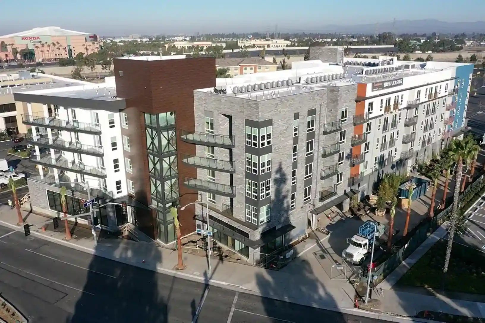
For example, drones capture high-resolution aerial images that show the entire site in one frame. These visuals are then used to compare real-time progress with project timelines and blueprints. As a result, potential delays or discrepancies are identified much earlier.
👉 Internal Linking Tip: Here, you can link to your Strategic Scheduling service page, since real-time monitoring directly supports on-time delivery.
2. Enhanced Safety and Risk Management
Safety is a top priority in construction, and drones help reduce the risks associated with traditional inspections. Instead of sending workers to dangerous heights or unstable areas, drones can safely capture images and video footage.
Additionally, drones can quickly inspect hard-to-reach areas such as roofs, scaffolding, or bridge structures. By reducing human exposure to hazards, companies lower the likelihood of accidents and injuries.
Moreover, data from drone inspections can be shared with safety managers to identify potential risks before they escalate. This proactive approach improves compliance with OSHA and local building regulations.
3. Accurate Mapping and Surveying
One of the most powerful applications of drones in construction is their ability to generate precise maps and 3D models. These aerial surveys are significantly faster and more affordable compared to traditional land surveying methods.
With drones equipped with GPS and advanced imaging technology, contractors can:
- Create topographic maps
- Measure distances and volumes (such as earthworks or stockpiles)
- Plan site logistics more effectively
As a result, drone surveys minimize errors, speed up the pre-construction process, and help keep projects within budget.
👉 Internal Linking Tip: Here, link to your General Contracting service page since accurate planning and mapping directly impact overall project success.
4. Better Communication and Transparency with Clients
Clients often struggle to visualize progress from traditional reports alone. Drone photography solves this by providing clear, high-quality visuals that make updates easy to understand.
Regular aerial images and videos can be shared with stakeholders, investors, and clients to demonstrate milestones achieved. In addition, drones enable virtual site tours, which are especially valuable for clients who cannot physically visit the project location.
This level of transparency not only builds trust but also strengthens the contractor-client relationship.
5. Supporting Project Recovery and Intervention
Sometimes, projects face delays, budget overruns, or unexpected challenges. Drone photography provides an objective view of the situation, allowing project managers to identify bottlenecks and adjust strategies quickly.
For instance, aerial footage can highlight areas where productivity is slowing or where subcontractors may be falling behind schedule. Armed with this data, contractors can intervene before issues escalate, ultimately saving time and resources.
👉 Internal Linking Tip: Link this section to your Project Recovery & Intervention service page to highlight how drones support recovery efforts.
Why Choose Conversion Building Group for Drone Photography in Construction?
At Conversion Building Group, we go beyond traditional contracting by leveraging innovative tools like drone technology. Our team uses drones to provide:
- Detailed aerial site inspections
- Progress reports with photo and video documentation
- Support for scheduling and budget management
- Safer, more efficient site monitoring
By integrating drones with our General Contracting, Strategic Scheduling, and Project Recovery services, we offer a complete solution for modern construction challenges.
Conclusion
The use of drone photography in construction is no longer optional; it’s essential. From enhancing safety and accuracy to improving communication and project recovery, drones are transforming how the industry operates.
At Conversion Building Group, we combine decades of contracting experience with cutting-edge drone technology to deliver projects that are safer, faster, and more efficient.
Ready to experience the benefits of drone-powered construction management? Contact Conversion Building Group today to see how our team can elevate your next project.
Drone photography in construction refers to using drones equipped with cameras to capture aerial images, videos, and data from job sites. These visuals help contractors monitor progress, improve safety, and provide accurate project updates.
Drones reduce the need for workers to access dangerous or hard-to-reach areas like rooftops, scaffolding, or unstable ground. By capturing aerial footage, contractors can identify hazards early and lower the risk of accidents.
Yes, drones provide real-time site monitoring and progress tracking. This makes it easier to identify delays, measure productivity, and adjust schedules promptly, ensuring projects stay on time and within budget.
At Conversion Building Group, we integrate drone photography with general contracting, scheduling, and project recovery. This approach ensures clients receive accurate data, safer site monitoring, and complete transparency throughout the project.